


Trekking trip around the Annapurna Massif via Thorong La
14-day trekking (5 – 8 hours daily)
Reach the highest point of the Annapurna circuit at the 5,416 m high Thorong La pass.
Get to know Hinduism and Buddhism in the pilgrimage site of Muktinath.
Hike through the fertile valley of the Marsyangdi River to Manang.
Annapurna South and Dhaulagiri See the sun shining from Poon Hill Trek
from Marpha to Kalopani through the wide Kali Gandaki Valley Marvel at the
seven UNESCO World Heritage Sites in the Kathmandu Valley
Itinerary
Day 1 Arrival in Kathmandu
When you arrive you will be transferred to the hotel in Kathmandu with our local tour guide. Depending on the time of arrival with flight , there is an opportunity to relax and take a first stroll through the old town of Kathmandu. Hotel rooms may not be available until after midday. In the evening we meet for a welcome dinner at the hotel or in a nearby restaurant – a good opportunity to get to know each other and discuss the activities of the following days.
Day 2 Kathmandu and Swayambunath
This day is free to go on excursions and sightseeing in the Kathmandu Valley with your tour guide (optional) or individually. We recommend visiting Kathmandu with Durbar Square and a walk to Swayambunath.
Day 3 Drive from Kathmandu via Besisahar to Jagat
We travel by bus from Kathmandu to Pokhara. We cross the Thankot Pass (1,500 m) before winding down into the Trisuli Valley. The partly bumpy, partly modern road follows the river through constantly changing scenery to Mugling. From there we follow the Marsyangdi Khola up the valley to Besisahar. Here we change to a local bus or jeeps and drive along a gravel road through the Marsyangdi Valley via Bhulbhule to Jagat (1,300 m). As we drive through small settlements and terraced fields, we gain a first impression of the village life of the Gurung population. Along the way, there are sweeping views of the gleaming snow peaks of Manaslu and Annapurna Himal. We drive up the valley via the town of Ngadi and the village of Bahundanda. The Marsyangdi has carved out a very deep gorge between Manaslu and Annapurna. Sometimes only the roar of the water can be heard, but the river cannot be seen. Finally we reach our lodge in Jagat via Syange.
Day 4 Trekking start and hike via Chamje and Tal to Dharapani
In the morning we start our trekking in Jagat. The further upstream we go, the more striking are the characteristics of this Buddhist-influenced culture – e.g. B. the stone-built houses with their flat roofs. The vegetation becomes less subtropical. At the bottom of the valley we hike through the deeply dug gorge. Between the village of Chamje and our destination Dharapani (1,860 m) we cross the river several times on sturdy suspension bridges.
Day 5 Hike via Timang to Chame
We stick to the left bank of the Marsyandi, passing through small villages and settlements. During our lunch break in Timang we have a beautiful view of the entire Manaslu massif. After the lunch break, the route continues steadily up and down to the administrative town of Chame at an altitude of 2,670 m. There are many small shops there that offer almost everything a trekker’s heart desires.
Day 6 Hike via Dhukur Pokhari to Pisang
We initially stay on the right side of the valley and continue hiking via Charting. Back on the left bank of the river, we climb up through sparse spruce and pine forests. If we walk up from the narrow valley to the town of Pisang (3,300 m), we have a wonderful view of the impressive peak silhouette of Annapurna II and the Pisang Peak (6,091 m). In the afternoon we can visit the Buddhist monastery in the Upper Pisang district. There we are directly opposite Annapurna – a fantastic view!
Day 7 Hike via Ghyaru to Ngawal
We follow the path on the eastern side of the river, hiking through beautiful coniferous forest and past a green pond. Then it goes up to Ghyaru in serpentines in about 1.5 – 2 hours. From there we follow a high path for 2 hours, which offers magnificent views of the Annapurna Himal, to the traditional village of Ngawal (3,660 m). Below us lies the Hongde airstrip on a plateau where herds of sheep and goats graze. If you want, you can climb up to a beautiful viewpoint in the afternoon and thus promote acclimatization.
Day 8 Hike via Braga to Manang
A descent takes us to Braga (3,440 m). Here the “German Bakery” tempts you with delicious apple pie. A short distance further, we reach the administrative center of Manang (approx. 3,500 m), a pretty mountain village with narrow streets and tightly packed flat-roofed houses. It lies above a glacial lake fed by the meltwaters of Gangapurna and Annapurna III. After moving into our lodge, we climb up to the Chongkor View Point. From there we have a wonderful view of the entire high valley of Manang and are directly opposite the Annapurna and Gangapurna.
Day 9 Trek to Yak Kharka
Well rested, our path now leads north in the Kone Valley towards Thorong La. Willow bushes and junipers characterize the route through the alpine landscape. For a long time we are accompanied by a magnificent view of the high valley of Manang with the Annapurna group, and in the background the Manaslu appears again! We hike past summer settlements to the hamlet of Yak Kharka, where we spend the night in a lodge at an altitude of 4,018 m. It is advisable to go for a short walk around the lodges today and tomorrow afternoon and otherwise rest. This benefits the further altitude adjustment, so that we are fit for the “royal stage”, the crossing of Thorong La, and can enjoy the long day.
Day 10 Hike via Churi Lattar to Thorong Phedi
Via the last small village Churi Lattar (4,150 m) we come to Thorong Phedi (4,450 m), the last simple accommodation before the Thorong La pass. Before crossing, we’re only on the road for half a day today, so we can rest and recharge our batteries for the rest of the day.
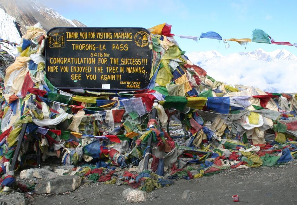
Day 11 Crossing the Thorong La pass and hiking to Muktinath
The most strenuous but probably most spectacular part of the tour is ahead: crossing the Thorong La. Today we have to complete the long stretch to Muktinath. Before dawn we set off with headlamps. The path leads in serpentines over stony terrain up to a large lateral moraine. This path has been used by local people on foot and horseback for centuries. It is very important to walk slowly and steadily. The altitude and possible snowfall or snow-covered paths can make things more difficult. Depending on your fitness, altitude adjustment and weather, we need around 4 – 6 hours to climb 1,000 meters before we reach the top of the pass (5,416 m) decorated with stone pyramids and fluttering prayer flags. When the weather is good, we have a magnificent panorama. Snow-capped 6,000-meter peaks tower on both sides of the pass. A break in the tea house at the pass (if open) rewards us for the exertions of the climb. The descent is first leisurely, then steeper downhill. We reach the beginning of the high valley via scree fields and then hike over the green valley floor down to Muktinath (3,800 m). We descend over 1,600 meters in altitude until we arrive at a lodge in the famous pilgrimage site after about 3 – 4 hours.
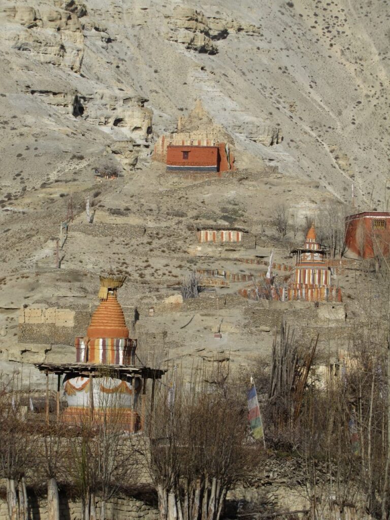
Day 12 Sightseeing in Muktinath and descent to Kagbeni
After the long and tiring day, we sleep a little longer today and then explore the monastery complex of Muktinath. The holy place is already mentioned in the early Hindu scriptures of the Mahabharata epic. Hindus revere the sacred springs of the Krishna Gandaki River, which emerge from a temple courtyard of 108 bronze gargoyles, while Buddhists revere the ever-burning sacred fire fueled by a natural gas well. After an extensive tour of the area decorated with many colorful prayer flags, we have lunch in Muktinath. In the afternoon we hike via Purang or Dzong, formerly the main town of this region, down to Kagbeni (2,800 m), above the Kali Gandaki River. A defiant gompa, stone houses and dark, winding streets characterize the medieval village. When the weather is good, the snow-capped peaks of the Tilicho and Nilgiri groups and the pyramid of Dhaulagiri shine.
Day 13 Drive from Kagbeni to Marpha and hike via Sauru to Kalopani
This morning a short ride by jeep or minibus takes us to Marpha. In this way we bridge a section that is unattractive for trekking. We reach Marpha (2,650 m) and from here hike through the now rugged landscape of the Kali-Gandaki Valley. On the less traveled path on the east side of the river, with great views of the Dhaulagiri range, we hike to the town of Sauru, where we take a lunch break. When the weather is clear, there are always wonderful views of the huge steep walls of the Dhaulagiri in the west and the Nilgiri in the east. Just beyond Sauru, the wide Kali Gandaki valley narrows and the strong winds abruptly die down. Via Kokethanti we reach Kalopani (2,500 m). Here we are exactly at the point between the eight-thousanders Dhaulagiri and Annapurna, which marks the deepest valley in the world.
Day 14 Drive to Tatopani and hike to Sikha
We travel by jeep or bus down the Kali Gandaki gorge to Tatopani (1,190 m). The climate here is already subtropical. The long town with many accommodations owes its name to the hot springs bubbling in the river gravel nearby. In the spring area, stone water pools entice you with a relaxing bath. In the afternoon, behind Tatopani, we cross the Kali Gandaki one last time over a large steel cable bridge and leave the huge gorge towards the northeast. From the mouth of the Ghar Khola we hike into the valley towards the Ghorapani Pass and, as we climb, we pass through varied cultivated land with individual farms and small towns. After a steep climb we reach Sikha (1,935 m).
Day 15 Hike via Chitre to Ghorepani
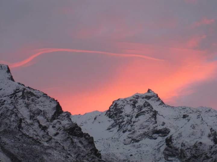
Via Chitre (2,390 m) we reach the village of Ghorepani (2,860 m). If you want, you can climb the 3,200 m high Poon Hill in about 45 minutes in the evening atmosphere. A magnificent panoramic view encompasses the ice flanks of the Dhaulagiri, Annapurna and Manaslu groups. The sunset can be spectacular.
Day 16 Sunrise climb at Poon Hill and trek to Ghandrung
In the light of our headlamps we climb up to Poon Hill in the morning and admire how the mountains are slowly bathed in light at sunrise. We are back in Ghorepani for breakfast. Then we continue on a scenic ridge path to the hamlet of Deurali (2,990 m). After lunch we descend along narrow paths into the rhododendron and bamboo jungle to the houses of Banthanti, and soon afterwards climb up into the jungle to Tadapani (2,690 m). Finally it goes steeply down to Ghandrung (1,940 m).
Day 17 Trek via Birethanti to Nayapul, drive to Pokhara
The scattered village of Ghandrung is a popular stopover thanks to its excellent location facing Annapurna South, Hiunchuli and Machhapuchare. After a hopefully atmospheric sunrise towards the Annapurna Sanctuary, we stroll through the sprawling Gurung village. We then descend the western slope of the Modi Khola valley and reach the valley floor via the town of Khimche. Soon we are in the village of Birethanti (1,040m). After the lunch break, we cross the steel cable bridge over the rushing Modi Khola and reach the road downstream at Nayapul. In the late afternoon we reach our hotel in Pokhara by bus over the 1,700 m high Khare Pass.
Day 18 Pokhara and Phewa Lake
The entire day is free to go on excursions and sightseeing in Pokhara with our tour guide (optional) or individually. We recommend a boat tour on Lake Phewa followed by a hike up to the Peace Stupa.
Day 19 Flight back to Kathmandu and sightseeing
After breakfast we drive to the airport and fly along the Himalayan chain to Kathmandu. The rest of the day is free to go on excursions and sightseeing in the Kathmandu Valley with your guide (optional) or individually. We recommend visiting Patan or alternatively Bhaktapur. In the evening we can meet for a farewell dinner in a restaurant (optional).
Day 20 Return flight
Transfer to airport.